Jaagruk Bharat is a private organization offering support for documentation and government scheme access. We are not affiliated with any government body. Official services are available on respective government portals. Our goal is to make processes easier and more accessible for citizens.
Jaagruk Bharat is a private organization offering support for documentation and government scheme access. We are not affiliated with any government body. Official services are available on respective government portals. Our goal is to make processes easier and more accessible for citizens.
Uttar Pradesh Bhu Naksha 2026: Meaning, Benefits, & Application Process
Updated: 29-04-2026 at 5:30 AM
1k

Serving Over
500K+ Users


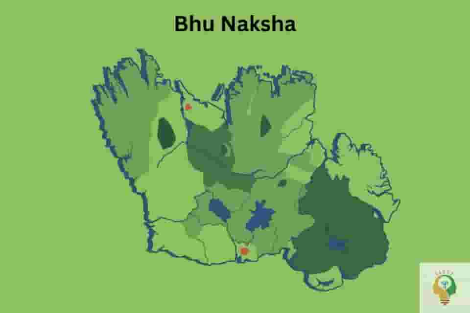
Bhu Naksha or Bhoomi Naksha is an extremely advanced digital land mapping system created by the National Informatics Centre (NIC) under the government of India. As its name suggests, this advanced spatial land mapping tool can be used by people to keep an eye on their lands with ease and comfort. It is not just limited to land owners in the state of Uttar Pradesh, but can also be easily accessed by other Indian citizens for various reasons, like making informed decisions before purchasing a property.
Read the article to learn the complete details on the UP Bhu Naksha system, ranging from its meaning and benefits to the process of accessing the portal and downloading the map of one’s land, including information about the differences between various records, like the Bhu Naksha, Bhulekh, and Sajra maps.
UP Bhu Naksha Overview
The table below summarises key details of the UP Bhu Naksha that one should know.
| Name of the system | UP Bhu Naksha |
|---|---|
| Created by | National Informatics Centre (NIC) under the government of India. |
| State governing bodies | Department of Revenue and the Department of Land Records and Survey. |
| Legal framework | Uttar Pradesh Revenue Code of 2006. |
| Purpose | To digitally view the maps of their land and other of its relevant details. |
| Coverage | All districts in the state of Uttar Pradesh. |
| Integrated with | Bhulekh for textual land records. |
| Legal status | Not legally used, just an informational tool. |
What Is Bhu Naksha UP?
Bhoomi Naksha, popularly known as Bhu Naksha UP, is a digital land mapping system created by the National Informatics Centre (NIC), government of India. The online portal is a part of India’s larger framework. i.e., the Digital India Land Records Modernisation Program (DILRMP), replacement of the old National Land Records Modernisation Program (NLRMP). The state govt authority that oversees its operations in the state is the Department of Revenue and the Department of Land Records and Survey (DLRS), and it functions as per the legal guidelines of the Uttar Pradesh Revenue Code of 2006.
The main aim behind the creation of this online portal is to allow people to keep a check on their lands using the modernised spatial technology created by the authorities. It also complements the Digital India mission, as here, the state government has successfully attempted to run a unified digital portal comprising people’s accurate land-related information in the state of UP.
Read More On Maharashtra 7/12 Land Document- Meaning, Use, & Application Process
Who Can Use The Bhu Naksha UP System?
Any citizen of India can use the services provided by the Bhu Naksha UP system, and not just people residing in the state of Uttar Pradesh with land holdings in any of the cities in the state. It can be used by land owners for checking their land-related information, and it can also be used by others for various reasons, like checking land details before buying someone’s land or for verifying someone’s land-related information before loaning them money, and many other such purposes.
Contents In A Map Obtained Via Bhu Naksha
The map of the land downloaded from the Bhu Naksha site comprises significant information, such as:
-
Exact and clear boundaries of the land. Boundaries of neighbouring lands are also shown for better spatial understanding.
-
Geographical coordinates (latitude and longitude) of the location of the land.
-
Total area of the land in square meters or hectares, for which the map is downloaded.
-
Land currently being used for whatever purpose.
-
Details of the owner of the land, along with the type of ownership.
-
Other relevant information concerning the land, like its khata khatauni number, khasra number, etc.
Benefits Of Bhu Naksha Uttar Pradesh
There are several benefits of using the Bhu Naksha portal, some of which are mentioned below in brief points for one’s reference:
-
The primary benefit of using this online portal is access to visually enhanced and accurate village maps that one can see from the comfort of their homes. One can also see specific plot-related maps along with their relevant details, like the details of the plot, information about the owner, etc.
-
As every bit of information in the online portal is verified and clear, it has considerably reduced land-related conflicts. And even if any conflict arises, they are resolved pretty quickly and easily without much complexity and ambiguity.
-
The online portal of Bhu Naksha is connected to various other official records, like the Bhulekh system, which helps people in efficiently cross-verifying the details of their land stored in national government records. If they do end up finding any discrepancies, they can start the correction process as quickly as possible and avoid any issues in the future.
Names Of All Districts In Bhu Naksha Uttar Pradesh
All the districts that are covered under the Bhu Naksha portal are mentioned below:
-
Agra.
-
Aligarh.
-
Ambedkar Nagar.
-
Amethi.
-
Amroha.
-
Auraiya.
-
Ayodhya.
-
Azamgarh.
-
Baghpat.
-
Bahraich.
-
Ballia.
-
Balrampur.
-
Banda.
-
Barabanki.
-
Bareilly.
-
Basti.
-
Bijnor.
-
Budaun.
-
Bulandshahar.
-
Chandauli.
-
Chitrakoot.
-
Deoria.
-
Etah.
-
Etawah.
-
Farrukhabad.
-
Fatehpur.
-
Firozabad.
-
Gautam Buddha Nagar.
-
Ghaziabad.
-
Ghazipur.
-
Gonda.
-
Gorakhpur.
-
Hamirpur.
-
Hapur.
-
Hardoi.
-
Hathras.
-
Jalaun.
-
Jaunpur.
-
Jhansi.
-
Kannauj.
-
Kanpur Dehat.
-
Kanpur Nagar.
-
Kasganj.
-
Kaushambi.
-
Kheri.
-
Kushinagar.
-
Lalitpur.
-
Lucknow.
-
Mahoba.
-
Maharajganj.
-
Mainpuri.
-
Mathura.
-
Mau.
-
Meerut.
-
Mirzapur.
-
Moradabad.
-
Muzaffarnagar.
-
Pilibhit.
-
Pratapgarh.
-
Prayagraj.
-
Rae Bareli.
-
Rampur.
-
Saharanpur.
-
Sambhal.
-
Sant Kabir Nagar.
-
Sant Ravidas Nagar (Bhadohi).
-
Shahjahanpur.
-
Shamli.
-
Shrawasti.
-
Siddharthnagar.
-
Sitapur.
-
Sonbhadra.
-
Sultanpur.
-
Unnao.
-
Varanasi.
Also Read On Making India's Infrastructure Better: The New Railway Land Leasing Rules
Land Codes & Their Meaning
The Bhu Naksha system uses several land codes for easy identification of various types of land. The codes are designed on the basis of the type of land, ownership, and the legal status that it entails. Some of the commonly used land codes are mentioned below in tabular format for one’s holistic understanding:
| Type of land | Description |
|---|---|
| Bajar (Barren land) | Land that cannot be used for cultivation purposes. |
| Khaad ke Gaddhe (Pit for Manure) | Plots that store manure; related to agriculture. |
| Khalihan (Agricultural) | Lands used for agricultural purposes. |
| Aabadi (Populated residential areas) | Areas where people live, for construction purposes. |
| Rekha rasta (road) | This code means roads for easy connectivity among different areas. |
| Chakrod (common use) | Land that is commonly used by the people. |
| STV | This code is for land set aside for special and specific purposes. |
| Gairmazarua aam | Land owned by the government for public use. |
| Gairmazarua khas | This type of land is owned by the govt but used only for specific purposes. |
How To Download A Land’s Bhu Naksha?
People have been given the option of downloading their respective Uttar Pradesh land records map through both online and offline means. Both the means of downloading one’s land’s map are broken down into steps below so that you can follow them easily.
Online Process
Step 1: Please visit the official website of the Bhunaksha UP portal and then select the name of the district, tehsil, and village where your land is.
Step 2: After filling in the details, the portal will show you the UP land map online of your village. Please select a specific UP khasra khatauni map of your land, and the selected map will be highlighted on the site.
Step 3: Navigate to the ‘Map report’ option. After selecting this option, the portal will display a PDF of a plot-wise report on your screen. Please download it on your device. Also, note that the portal
Offline Process
Step 1: Please visit the office of the local revenue officer, the Tehsildar’s office, or the Lekhpal’s office in your area.
Step 2: Request the staff members to help you with the UP property map download process. Provide them with all the required documents and information, like the name of the owner of the land, the khata khatauni number, etc. After conducting a quick verification check, the staff members will provide you with a downloaded copy of your land’s Bhu Naksha.
How To Report And Correct Errors In Bhu Naksha Records?
Note that one can correct or update errors concerning their land-related information in the Bhu Naksha records, if there are any. The process of updating details is as follows:
Step 1: Visit the official UP Bhunaksha online website and go to the ‘Report Error’ section.
Step 2: The portal will first ask you for some of your land-related details, like the khasra number, khatauni number, and others, and then will ask you to report any errors you have noticed concerning your land-related information in the official records.
Step 3: Enter the details that need to be corrected. Also, upload the scanned copies of some supporting documents, like the ownership-related documents, the sale deed of the land, etc., as evidence.
Step 4: After verifying your details, the authorities will correct the error and update the information that needs to be corrected. Keep checking the website at regular intervals to be aware.
How To Match Data In Bhu Naksha With Information In The Bhulekh System?
The Bhu Naksha system and the Bhulekh system are related to land but differ when it comes to their specific functions. And because they are different, everyone is advised to cross-check their respective land-related information stored in both the official records. The process of doing the same is as follows:
Step 1: Please visit the website of UP Bhulekh and note the khasra number of your land from the site.
Step 2: Open another webpage of the Bhu Naksha website and then select the name of the district, tehsil, and village where your land is.
Step 3: With the help of the land’s khasra number, locate your land on the site, after which your land’s map will be visually focused by the portal.
Step 4: Please cross-verify your land’s details from both the official records, such as the owner’s details, area of the land, type of land, boundaries, etc. If you end up finding any errors or mismatches, contact the local office of the Tehsildar or the Lekhpal of your area to correct them.
How To Check Mutation Status Via The Bhunaksha UP Portal?
Mutation of a land simply means that the ownership-related details of a land, especially after its transfer, have been updated in the official govt records. One can check the status of their respective land’s mutation by following the stepwise process described below:
Step 1: Visit the official Bhulekh website and then navigate to the option concerning ‘View Copy of Khatauni (Record of Rights). Enter the name of the district, tehsil, and village where your land is located.
Step 2: The portal will show you your land-related information. The name of the land’s owner may still be old. Please update it with the help of the supporting documents for the transfer of ownership and sale.
Step 3: On another tab, visit the official UP Bhunaksha online website, and enter the required information about the location of your land.
Step 4: Focus on the map of your land and then cross-check the details with the Bhulekh records. The Bhunaksha portal might not show the land’s ownership-related information directly, but it does contain information concerning ownership and boundaries of the land with the help of the revenue records.
Note that if the old details are still being shown on both portals, the mutation status of your land is still unsuccessful. Contact the local office of the Tehsildar or the Lekhpal of your area on an urgent basis and request them to help you in correcting these details to avoid any issues and discrepancies in the future.
How To Check Land Encroachment Via The Bhunaksha UP Portal?
One of the functions of the Bhunaksha UP portal is to help people keep an eye on their lands, meaning they can see and detect if any unauthorised person is trying to illegally capture their land for personal use. The process of detection via the online website of Bhu Naksha is as follows:
Step 1: Please visit the official website of the Bhunaksha UP portal and then select the name of the district, tehsil, and village where your land is.
Step 2: The portal will show you the village’s map. Navigate to your land’s map using unique information like its khasra number.
Step 3: Landowners have to see the boundaries of their land using the ‘zoom’ feature. Land encroachment can be detected if buildings are shown as crossing over the lines, the plot area looks smaller than before, or if your land boundaries are getting mixed with neighbouring plots.
Step 4: Landowners can easily use the measurement tools available in the portal to measure the width and length of their respective lands. Cross-check the land measurements with the measurements mentioned in the bhulekh records, and if you find any differences, there are high chances of some unauthorised person trying to encroach on your land.
Take a screenshot of your findings and report them to the local office of the Tehsildar. Request a physical site verification from the Lekhpal of your area, and apply for physical boundary demarcation (Napi) to confirm that someone is illegally using your land.
Difference Between Bhunaksha, Bhulekh, & Sajra Maps
Key differences between the Bhunaksha, Bhulekh, and Sajra map systems are mentioned below in tabular format:
| Component | Bhunaksha | UP Bhulekh Naksha | Sajra |
|---|---|---|---|
| Meaning | Digital mapping of the land. | Textual record of lands in the state of UP. | Traditional paper-based village maps. |
| Issued by | National Informatics Centre (NIC). | Online Bhulekh site for ease of use. | Lekhpal or the revenue department. |
| Comprises details | Geographical area and corresponding coordinates, shape of the plot, type of land, and boundary overlays. | Khata khatauni number, khasra number, owner’s details, type of land, mutation status, etc. | Land khasra number, owner’s information, plot boundaries, and information concerning neighbouring plots. |
| Validity | Not legally binding. | Legally accepted for one’s ownership over a land. | Can be used in legal matters. |
Also Read On UP Labour Card: UPBOCW Benefits, Registration, Renewal, And Schemes
Conclusion
Bhu Naksha Uttar Pradesh is a transformative creation of the NIC for the people residing in the state of Uttar Pradesh. With the help of this advanced online spatial tool, people can easily view their lands, access land-related details, check the accuracy of the stored information, correct any errors if found, and overall help the government in maintaining a verified and accurate digitised record of lands in Uttar Pradesh.
Stay updated with Jaagruk Bharat to get the latest information on government schemes and more, and reach out to us via our community page if you have any questions.
Why Choose Jaagruk Bharat To Apply For A 7/12 Document?
Allow Jaagruk Bharat to help you in applying for a 7/12 document on your behalf in just a few clicks! Get 24/7 support, expert assistance, online services, and a hassle-free application process with Jaagruk Bharat.
0

0

1k

0
0
1k Views
0
No comments available


Our Company
Home
About
T&C
Privacy Policy
Eula
Disclaimer Policy
Code of Ethics
Contact Us
Careers
Cancellation & Refund Policy
Categories
Women
Insurance
Finance
Tax
Travel
Transport & Infrastructure
Food
Entertainment
Communication
Government ID Cards
E-commerce
Traffic guidelines
Miscellaneous
Housing and Sanitation
Sports
Startup
Environment and Safety
Education
Agriculture
Social cause
Employment
Disclaimer: Jaagruk Bharat is a private organization offering support for documentation and government scheme access. We are not affiliated with any government body. Official services are available on respective government portals. Our goal is to make processes easier and more accessible for citizens.
All Copyrights are reserved by Jaagruk Bharat